
Survey & Geospatial Services
Survey & Geospatial Services
SERVICES
- Fracture Boundary Survey
- Topographic Survey
- Right-of-Way Mapping
- Site Survey
- Railroad Track Survey
- Construction Layout
- Utility Identification and Mapping
- Stormwater Outfalls Mapping
- Fathometer Survey
- GIS Mapping Services
- GNSS Surveys
- 3-D Laser Scanning - High Definition Survey
- Precise Structural Deformation Survey
KS Engineers, P.C. (KSE) is a leading provider of comprehensive land surveying and geospatial services throughout the tri-state region. Our capabilities include boundary and topographic surveying, base mapping, right-of-way mapping, GPS control surveys, and advanced geospatial solutions such as GIS integration and terrestrial laser scanning. KSE supports a wide range of projects for public sector transportation agencies and private industry clients, delivering accurate, reliable survey data critical to planning, design, and construction.
KSE maintains a full-service Land Surveying Department staffed by licensed professionals in New York and New Jersey, supported by experienced field crews and CADD technicians. With over 100 years of combined experience, our personnel bring a forward-thinking approach that integrates technical expertise with a strong understanding of client needs, particularly for schedule-driven infrastructure projects. Our team is committed to delivering precise, defensible, and efficient mapping products that support informed decision-making throughout all project phases.
The firm invests in state-of-the-art surveying equipment and software to ensure accuracy and productivity. Our resources include advanced GPS systems, robotic and reflectorless total stations, digital data collection platforms, and industry-leading processing software. KSE field crews utilize Leica GPS and total station instruments with integrated data collection, enabling efficient and flexible field operations across a wide range of site conditions and project complexities.
KSE emphasizes professional development and technical proficiency. Our survey and CADD personnel are well-versed in current methodologies and platforms, including Bentley MicroStation, InRoads, and AutoCAD, and receive ongoing training to remain aligned with evolving technologies, industry standards, and best practices.
Our experience in boundary, right-of-way, and topographic mapping includes comprehensive records research—deeds, tax maps, easements, county records, and railroad valuation maps—to develop accurate survey baselines integrated with field data. KSE has extensive experience supporting governmental agencies across New York, New Jersey, and Pennsylvania, and has developed efficient workflows to meet varying agency standards while delivering high-quality mapping in MicroStation or AutoCAD formats with strict adherence to quality control protocols and project schedules.
Related Projects

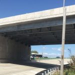
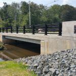
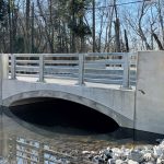
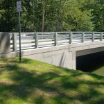

SERVICES
SERVICES
- Fracture Boundary Survey
- Topographic Survey
- Right-of-Way Mapping
- Site Survey
- Railroad Track Survey
- Construction Layout
- Utility Identification and Mapping
- Stormwater Outfalls Mapping
- Fathometer Survey
- GIS Mapping Services
- GNSS Surveys
- 3-D Laser Scanning - High Definition Survey
- Precise Structural Deformation Survey
KS Engineers, P.C. (KSE) is a leading provider of comprehensive land surveying and geospatial services throughout the tri-state region. Our capabilities include boundary and topographic surveying, base mapping, right-of-way mapping, GPS control surveys, and advanced geospatial solutions such as GIS integration and terrestrial laser scanning. KSE supports a wide range of projects for public sector transportation agencies and private industry clients, delivering accurate, reliable survey data critical to planning, design, and construction.
KSE maintains a full-service Land Surveying Department staffed by licensed professionals in New York and New Jersey, supported by experienced field crews and CADD technicians. With over 100 years of combined experience, our personnel bring a forward-thinking approach that integrates technical expertise with a strong understanding of client needs, particularly for schedule-driven infrastructure projects. Our team is committed to delivering precise, defensible, and efficient mapping products that support informed decision-making throughout all project phases.
The firm invests in state-of-the-art surveying equipment and software to ensure accuracy and productivity. Our resources include advanced GPS systems, robotic and reflectorless total stations, digital data collection platforms, and industry-leading processing software. KSE field crews utilize Leica GPS and total station instruments with integrated data collection, enabling efficient and flexible field operations across a wide range of site conditions and project complexities.
KSE emphasizes professional development and technical proficiency. Our survey and CADD personnel are well-versed in current methodologies and platforms, including Bentley MicroStation, InRoads, and AutoCAD, and receive ongoing training to remain aligned with evolving technologies, industry standards, and best practices.
Our experience in boundary, right-of-way, and topographic mapping includes comprehensive records research—deeds, tax maps, easements, county records, and railroad valuation maps—to develop accurate survey baselines integrated with field data. KSE has extensive experience supporting governmental agencies across New York, New Jersey, and Pennsylvania, and has developed efficient workflows to meet varying agency standards while delivering high-quality mapping in MicroStation or AutoCAD formats with strict adherence to quality control protocols and project schedules.
Related Projects